
By Salma El-Sakka
A wave of intense and unpredictable typhoons intensified by the El Niño weather pattern has killed dozens, shut major airports, and devastated crops and infrastructure across East Asia in recent months, affecting the Philippines, Taiwan, China, and Japan.
Record-breaking storms
In October, Typhoon Champi, packing winds of 295 km/h (193 mph) equivalent to a Category 5 hurricane, threatened Taiwan's 23 million residents before skirting the island. The storm forced hundreds of flight cancellations in Hong Kong, Taiwan, and Japan, while huge waves closed seaside highways in the Philippines' Batanes archipelago and cut power to 15,000 homes in Japan's Okinawa islands.
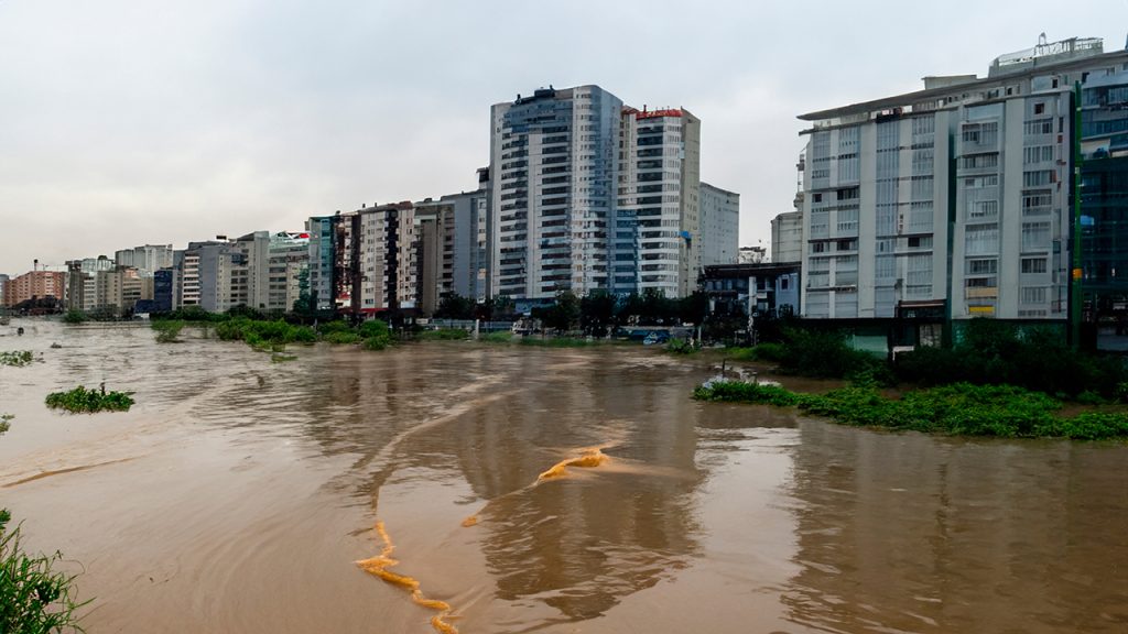
Earlier, in June, Typhoon Mekkhala and Severe Tropical Storm Higos approached Japan's eastern coast simultaneously, prompting the evacuation of one million people. In July, Tropical Storm Narra submerged villages along China's Guangxi coast, displacing tens of thousands. August brought Super Typhoon Dolphin, which churned across the Pacific for 16 days before slamming into eastern China, causing heavy floods and dozens of casualties. Later that month, Typhoon Saudel made landfall in three southeastern Chinese cities over a week, disrupting transport and forcing thousands to evacuate.
El Niño's role
El Niño, a naturally occurring climate phenomenon where warm waters pool in the eastern Pacific, occurs every two to seven years and typically lasts about a year. The UK Met Office has forecast this year's event to be the "strongest in living memory," likely lasting until February or March. The Pacific Ocean, heated to record levels, is brimming with typhoon energy, according to the Accumulated Cyclone Energy (ACE) metric. This year's ACE reading for Southeast and East Asia is forecast to be nearly double the 30-year average.
El Niño has also altered wind patterns, causing typhoons to form further east than usual and allowing them to strengthen over warm waters for longer periods. Sea surface temperatures in the equatorial Pacific soared to 4°C above normal last month, the highest since records began in 1949, surpassing the previous record of 3.6°C set in December 1997. China's climate agency warns temperatures will continue rising over the next three months.
Expert warnings
"The Pacific can be likened to someone 'burning with fever,'" said Ana Liza Solis, head of climatology at the Philippines' national weather bureau, at a September press briefing in Manila. "It can go into convulsions soon." Climatologist Rafaela Jane Delfino and colleagues simulated the effects of warmer conditions on past monster storms, including 2013's Super Typhoon Haiyan, which killed more than 6,000 people. They found higher temperatures increased total accumulated rainfall by 26%, a devastating prospect for a country where flooding from monsoon rains and about 20 tropical storms per year is a primary disaster risk.
Preparation efforts
Countries are bracing for immediate impacts. Japan has urged citizens to stockpile food and essentials and secure outdoor furniture. China has directed local officials to identify vulnerable areas and is upgrading warning and monitoring systems. The Philippines and its Southeast Asian neighbors are preparing for disruptions to food production, especially rice, and have increased support for farmers, including fertilizer provision.
Long-term concerns
The United Nations Development Programme in Asia and the Pacific recently said the window for governments to act on El Niño is "closing." It emphasized that a community's resilience is determined years in advance by infrastructure planning, water management, social protection coverage, and budget flexibility. "Every El Niño tests the resilience we have built; this one should also drive us to build more," the agency added.